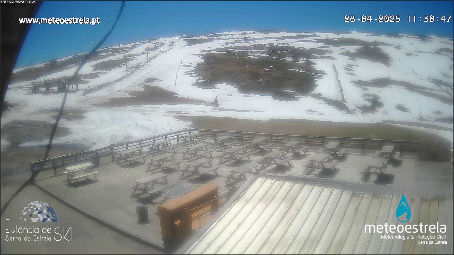
Imagens captadas cerca das 00h00
* * *

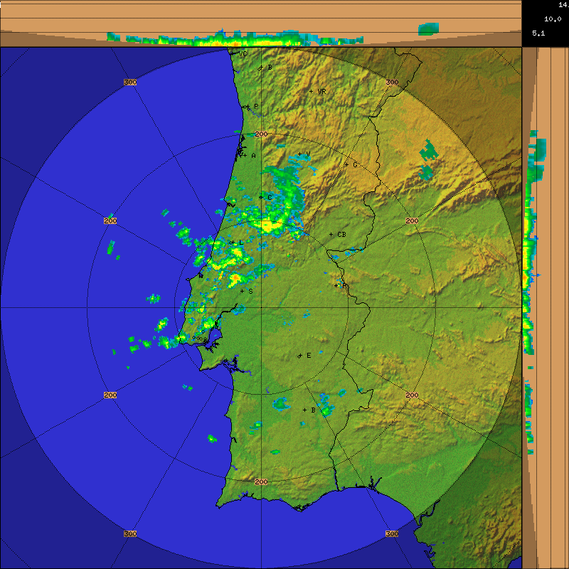
Situação meteorológica bastante adversa, com ocorrência de
períodos de chuva forte a muito forte, acompanhado por rachadas de vento
muito forte. Temporal no mar.
Tropical Storm (soon to be post-tropical) Nadine
has finally shown her strength. The winds have picked up as predicted and can
reach speeds up to 40 gusting to near 65 mph through the night into early
morning tomorrow. The gusts come in big...
wallops due to the showery nature of the rain.
These big “jumps” in wind speed can knock things lose that would otherwise stay
put with a slower increase in winds. Keep that in mind if you need to be out,
what out for flying debris.
Our biggest concerns are with her rain bands. We expect these moderate to heavy rains to remain in the area for most of the night. This will lead to some significant accumulation, upwards of 2” of rain is possible, especially on the North Eastern portion of Terceira. This will cause problems in low lying areas and steep hillsides/banks. If you have the option, don’t drive around tonight. If you must be out, Be VERY careful this evening for water related hazards.
Our biggest concerns are with her rain bands. We expect these moderate to heavy rains to remain in the area for most of the night. This will lead to some significant accumulation, upwards of 2” of rain is possible, especially on the North Eastern portion of Terceira. This will cause problems in low lying areas and steep hillsides/banks. If you have the option, don’t drive around tonight. If you must be out, Be VERY careful this evening for water related hazards.


Sem comentários:
Enviar um comentário